Boerne, Texas......30 miles west of San Antonio. Why are we here...........well, we were hoping to be on our way to Louisiana today, but the engine light came on in the vehicle and here we sit in a Chrysler dealership waiting for the $$$$$ news, and......... we'll probably lose a day here.
Before this delay, the trip has been good. Got out of Tucson without a hitch on Sunday and had a pleasant drive with a few stops along the way. Our trip taking us through the Gadsden Purchase. (here comes a history lesson.)
 In 1846, President Polk declared war on Mexico and sent troops to New Mexico and California under General Kearny. This began the military era in New Mexico, which lasted for about 50 years. At this time, Mexican troops were garrisoned in Mesilla. By 1848 the war had ended and most of the state had been ceded to the United States by the Treaty of Guadalupe Hidalgo.
According to the treaty, the boundary between the United States and Mexico was to extend from the Gulf of Mexico and follow the Rio Grande to a point eight miles north of El Paso and then continue west to the first branch of the Gila River. The boundary was established from a map drawn by J. Disturnell of New York. When the United States sent men to survey the boundary, they found that the Disturnell map was in error. El Paso was actually located 40 miles north of its position on the map and the Rio Grande was actually 130 miles to the west. A settlement was made between the two countries known as the Gadsden Purchase, but diplomatic tension followed. In 1853, the United States negotiated with Mexico to resolve the boundary dispute which resulted at the termination of the Mexican War and to purchase the land in question. This was known as the Gadsden Purchase.One of the most spectacular sights while driving is still in Arizona called Texas Canyon. Located in Cochise County, Arizona about 20 miles east of Benson, AZ on I-10 and lies between the Little Dragoon Mountains on the north and the Dragoon Mountains to the south.
Known for its giant granite boulders, the canyon frequently attracts
rockhounds and photographers. The stagecoach route of the
Butterfield Overland Mail passed through Texas Canyon from 1858 until the outbreak of the Civil War in 1861 when the stage line suspended operations. Historically within the range of the
Chiricahua Apache, Cochise made his last stronghold near here in the Dragoon Mountains during the mid-1870s.
In the mid to late 1880's David A. Adams arrived from Coleman County Texas, soon to be followed by other family members. Hence the name Texas Canyon - there were "a bunch of damned Texans up there." Descendants still live and raise cattle on the old family ranch.
The Amerind Foundation, a privately funded archaeological research facility, library, museum and art gallery founded by William Shirley Fulton in the 1930s lies about a mile south of I-10 in Texas Canyon at Exit 318.
The Triangle T Guest Ranch also lies about a mile south of I-10. This historic Guest Ranch has overnight accommodations, (RV sites,
casitas) a Saloon and restaurant. The ranch has been the filming location for many commercials, movies and TV shows. We were headed to Las Cruses for the night, but maybe this would be a good over night stop when we drive by next year. It's definately in Ada's memory bank........


New Mexico's state bird is the Roadrunner

This is the godzilla of roadrunners that greets you when entering New Mexico.......
Officially adopted March 16, 1949. It was adopted under the name "Chaparral Bird". In Spanish, it is called "El Correcaminos". The comical roadrunner prefers running to flying and has been clocked at speeds of 15 miles per hour. They are approximately 22 inches in length and their diet consists of insects, lizards, centipedes, mice and snakes. They have been know to eat French fries as well.............. mine off my plate!


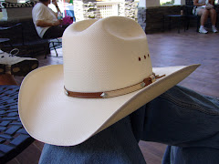
 Not quite the Mini-Cooper Donald wanted to rent, but it's what they call in the rental business, an "economy car". Not even enough room to wear his Stetson. How can they even have these cars in Texas? In any case, making a bad situation tolerable, we got our room back at the Hampton Inn and dropped off our gear and went for a ride to


 This is the godzilla of roadrunners that greets you when entering New Mexico.......


.jpg)


